Delving into the divisive waters of river basin planning in Bolivia: A case study in the Cochabamba Valley
Introduction
River basin planning in Bolivia is a relatively new endeavor that is primed for innovation and learning. One important learning opportunity relates to connecting watershed planning to processes within other planning units (e.g., municipalities) that have water management implications. A second opportunity relates to integrating watershed management, with a focus on land-based interventions, and water resources management, with a focus on the use and control of surface and groundwater resources.
Bolivia’s River Basin Policy and its primary planning instrument, the River Basin Master Plan (PDC in Spanish), provide the relevant innovation and learning context. Official guidance related to PDC development lacks explicit instructions related to the use of analytical tools, the definition of spatially and temporally disaggregated indicators to evaluate specific watershed and water management interventions, and a description of the exact way stakeholders engage in the evaluation process.
This paper describes an effort to adapt the tenets of a novel planning support practice, Robust Decision Support (RDS), to the official guidelines of PDC development. The work enabled stakeholders to discern positive and negative interactions among water management interventions related to overall system performance, hydrologic risk management, and ecosystem functions; use indicators across varying spatial and temporal reference frames; and identify management strategies to improve outcomes and mitigate cross-regional or inter-sectorial conflicts.
This weADAPT article is an abridged version of the original text, which can be downloaded from the right-hand column. Please access the original text for more detail, research purposes, full references, or to quote text.
Case study: the Rocha River Basin
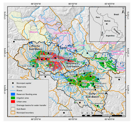
The Rocha River Basin has an area of approximately 3,699 km2 and a population of almost 1,300,000 people (13% of the country). Climatically, 80% of the annual precipitation is concentrated between the months of December and March, 2% between the months of May and August, and the remaining precipitation in the months of the transition seasons (April, September to November).
Challenging climatic conditions are likely to worsen under projected climate conditions. According to the Institut Pierre-Simon Laplace model for Representative Concentration Pathway 8.5 (RCP8.5), the annual precipitation could be reduced by 7%. In some months of the rainy season (February and March), precipitation could be reduced by up to 30%. The dry season could be even drier with reductions of up to 77%.
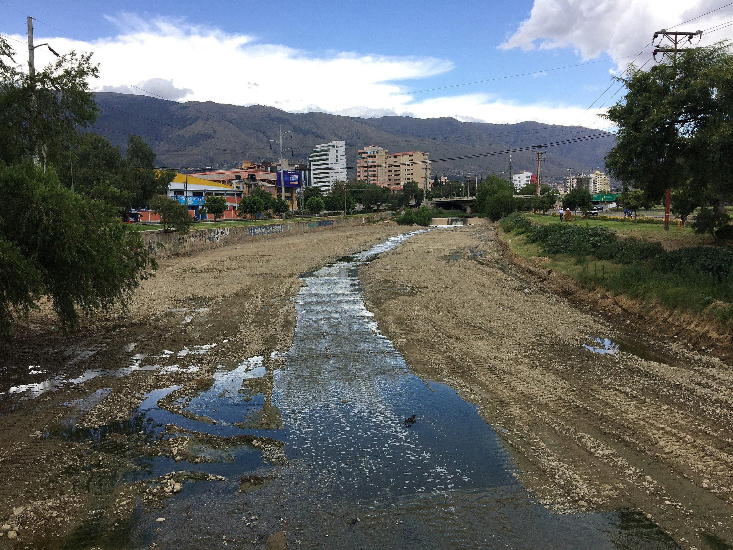
Limited water availability due to the prevailing semi-arid climate as well as long-standing conflicts over access, governance, and environmental degradation contribute to the basin’s water-related challenges. Cochabamba, Bolivia’s third largest city, has experienced conflicts over the expansion of water access, particularly in the rural areas.
Bolivia’s Ministry of the Environment and Water and the Cochabamba Departmental Government have decided to update the River Basin Master Plan (PDC) by formulating a package of medium- and long-term actions based on three main factors:
- climate change considerations;
- the development of analytical tools;
- the broad participation of key stakeholders in the basin.
Methodology
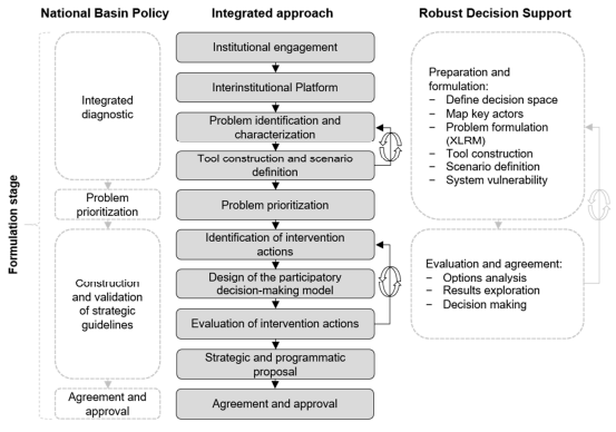
The RDS framework developed by Purkey et al. and Bolivia’s guiding framework of the PDCs provided our methodological approach for the formulation of a river basin master plan supported by participatory water resources systems modeling (Figure below).
The RDS framework has two phases: (i) preparation and formulation and (ii) evaluation and agreement. The first phase has six steps to identify the current and future vulnerability of the system. The second phase is a three-step participatory-driven process for the assessment of different management options leading to the identification of robust actions (actions that can satisfy disparate objectives under the assumed uncertainties).
An essential step of this framework is the formulation of the problem using the XLRM matrix, where (X) stands for the uncertainties, (L) stands for the management options, (R) stands for the analytical tools that relate the (X) and (L), leading to performance measures, and (M) is used to evaluate the potential options.
The guiding framework of the PDC contemplates three stages: formulation, implementation, and evaluation and monitoring. Each of these stages has a step-by-step process with general guidelines are in the figure below. All stages rely on public participation of the basin’s institutions and actors as an essential element to promote environmental governance.
For more detailed information about the methodology, you can download the original document on the right hand side.
Lessons Learned
The research on river basin planning in Bolivia provided several valuable lessons and insights, including:
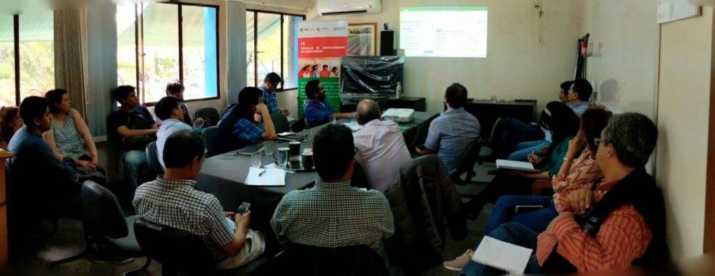
- Importance of stakeholder engagement: The research highlighted the critical role of stakeholder engagement in the planning process. Involving a diverse range of stakeholders, including local experts, government institutions, universities, and community members, was essential for gathering input, addressing concerns, and fostering collaboration in developing water management strategies.
- Need for data quality and credibility: The research underscored the importance of data quality and credibility in modeling tools used for river basin planning. Overcoming initial stakeholder concerns about data insufficiency required partnerships with local universities, intensive fieldwork, and transparent communication to enhance the reliability of the watershed modeling process.
- Value of iterative decision-making: The iterative nature of the Robust Decision Support (RDS) process proved valuable in the planning process. By allowing for continuous improvement, adjustments, and feedback incorporation based on stakeholder inputs and evolving climate change scenarios, the research demonstrated the benefits of adaptive decision-making in addressing water management challenges.
- Consideration of potential conflicts and trade-offs: The research highlighted the importance of identifying and addressing potential conflicts and trade-offs associated with intervention actions, such as water transfers, in the Cochabamba Valley. Quantifying the impacts of proposed actions using modeling tools enabled stakeholders to negotiate and propose compensation measures within the planning process.
- Integration of climate change adaptation strategies: The research emphasized the significance of integrating climate change adaptation strategies into river basin planning efforts. By considering short-, medium-, and long-term climate change scenarios, the research demonstrated the importance of developing adaptive measures to enhance the resilience of water management practices in response to uncertain future conditions.
- Challenges and areas for further research: The research highlighted challenges such as data limitations, resistance to modeling tools, conflicts around intervention actions, and the need for integrating territorial-based actions into water resource system modeling. It identified the importance of further research to address these challenges and enhance participatory decision-making processes in water management.
(0) Comments
There is no content