The Global Mountain Explorer
Introduction
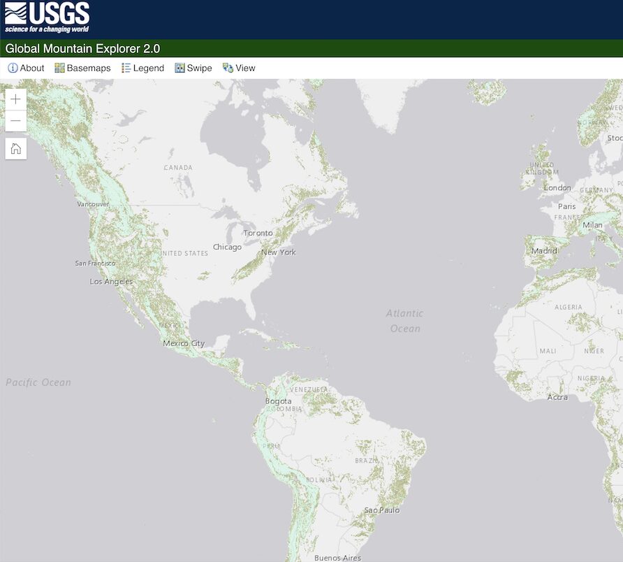
There have been surprisingly few attempts to rigorously and consistently define and map Earth’s mountains. The Global Mountain Explorer (GME) (v2.0) was developed by the U.S. Geological Survey (USGS), in partnership with Esri, the Center for Development and Environment of the University of Bern (CDE), the Global Mountain Biodiversity Assessment (GMBA), and the Mountain Research Initiative (MRI) as a contribution to GEO Mountains. It presents delineations of mountains according to three established approaches, enabling comparison between them.
Take a look at the Global Mountain Explorer 2.0 and find out more about the online tool on their homepage.
Methodology
The three existing mountain delineations were collated and presented in the form of an interactive map, with which any location can be queried. In addition, the spatial data can be freely downloaded.
Key messages
Mountain delineations are required for many research and policy applications, including in relation to climate change adaptation. GME provides a simple and efficient way to compare and access these layers, enabling the assessment of the impacts of different mountain delineation choices.
Further resources
Suggested Citation: The Global Mountain Explorer, v2.0. USGS. https://rmgsc.cr.usgs.gov/gme/
Related resources
Global Network for Observations and Information in Mountain Environments

IPCC WGII Sixth Assessment Report Cross-Chapter Paper 5: Mountains

Climate, DRR and Environment Nexus Brief: Mountains in a Changing Climate
(0) Comments
There is no content