Conflict, Migration and Land Regeneration; A Tale of Kanyerus
Summary
Kanyerus, appears synonymous to ‘peace building’ ‘conflicts’ ‘reconstruction’ and relatable words indicating rebuilding of a community. A recent visit to the area affirmed that the reality of these sentiments is not far from the truth.
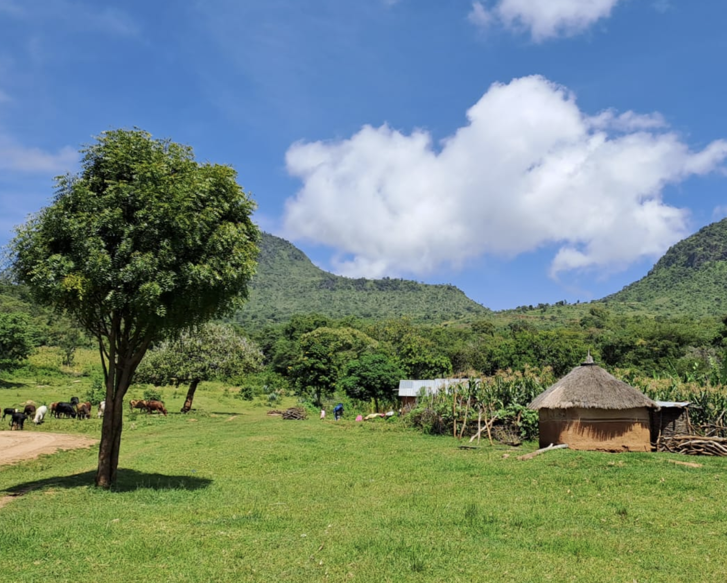
In Kenya, Kanyerus is a locality, situated East of Riwo ward in West Pokot County. It borders Uganda from the Western side. The two bordering Pokot and Karamoja communities have experienced conflicts mainly triggered by livestock raiding and competition for water and pasture. This has been aggravated by severe droughts, proliferation of weapon from war-torn countries, gradual disappearance of customary conflict mitigation institutions and inadequate state protection.
In 1997, as recalled by Mzee Lokutani (Not his original name) in Kanyerus, the Karamoja’s attacked their community in stealing more than 1000 livestock in form of cows and goats leading to the deaths of considerable number of both Pokots and Karamojas. The gravity of this particular event forced most of the Pokots to relocate outside Kanyerus and find refuge among family and relatives.
The narration by Mzee Lokutani can be retold in many versions and in different set-ups, but this is largely missing in documented files. This story map aims to bring to attention the unique situation in Kanyerus, with regard to ecosystem rehabilitation over the span of time recounted by Mzee Lokutani, when the community moved away from the area to their influx return from 2007.
Ecological degradation and restoration in the context of conflicts is an area that is yet to be fully explored. The nexus often emerges when discussing the causal effects.
This story map envisions to showi) how conflicts, which caused the relocation of people, led to natural rehabilitation and regeneration of the degraded land in Kanyerus village; and ii) highlight how the village is currently emerging as an important wetland for human use and a thriving biodiversity.
This article is an abridged version of the ArcGIS StoryMap (full-screen version), where it was originally published on 19 October 2022: Conflict, Migration & Land Regeneration; A Tale of Kanyerus. Please access the original text for more detail, research purposes, full references, or to quote text.
Scroll down on this image to explore the story in full!
Suggested Citation:
Onyango, S., Adoyo, B. and Mungo, C. (2022). Conflict, migration and land regeneration; A tale of Kanyerus. Available at: https://storymaps.arcgis.com/stories/e19850b48a7c4d1f91146029914d08c7
Related resources
- Safeguarding livelihoods and promoting resilience through National Adaptation Plans– Case study: Kenya
- Building Resilient Communities, Wetland Ecosystems and Associated Catchments in Uganda
- Nature-based Solutions in Action: Lessons from the Frontline
- Migration for Adaptation: A Guidebook for Integrating Migration and Translocality into Community-Based Adaptation
- Addressing the Land Degradation –Migration Nexus
- Climate Change & Environment Nexus Brief: Fragility and Conflict
(0) Comments
There is no content