Protecting groundwater for climate resilience and water security in Turkana
Summary
- In Kenya’s Turkana County, groundwater research by the University of Nairobi is contributing to new policy (including the Turkana Climate Change Act) and practice to protect the Lodwar Alluvial Aquifer System and enhance resilience to climate risks.
- Tritium analyses indicate that potable groundwater is recharged by recent or ‘modern’ rainfall, and is therefore vulnerable to climate variability.
- Findings point to the critical need for local to regional scale environmental protection measures and for continuous monitoring of the surface and groundwater quality in order to secure groundwater resources over the long-term.
This weADAPT case study is an abridged version of the original text, a Story of Change from the REACH programme. It can be downloaded from the right-hand column. Please access the original text for more detail, research purposes, full references, or to quote text.
Introduction
Lodwar Town, located within Turkana County, is a fast-growing town in sub-Saharan Africa. With a 42.5% population increase between 2009-2019, Lodwar has experienced a sharp increase in water demand due to urban growth. In addition, industrial demand for water is on the rise due to oil production activities, mega-transport development and infrastructure projects such as the Lamu-South Sudan-Ethiopia (LAPSSET) corridor, and the expansion of commercial and industrial establishments.
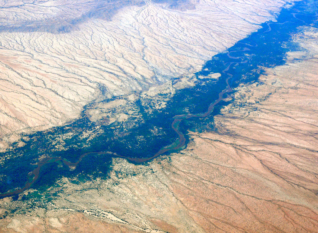
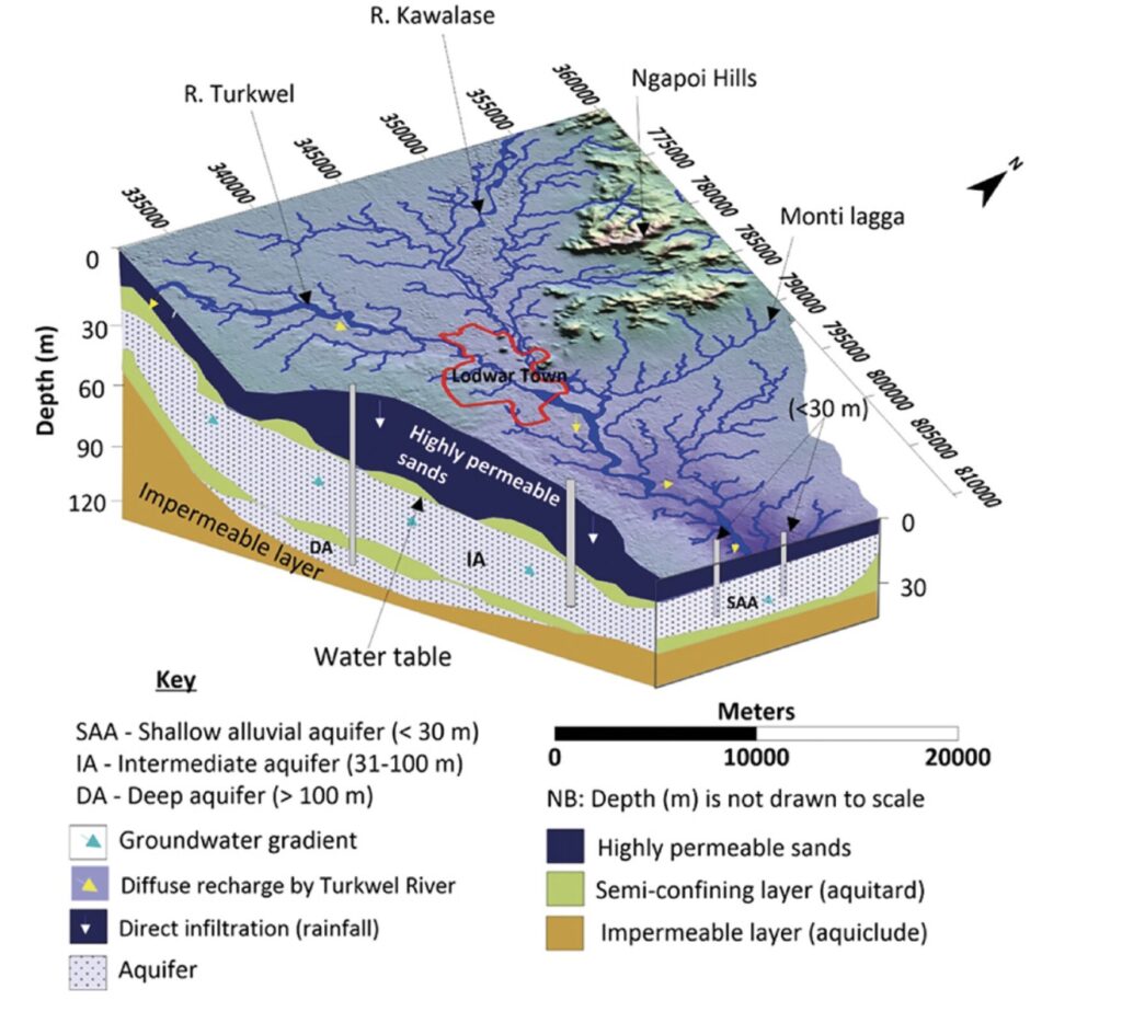
Reliable surface water supplies in the region are limited, due to low and erratic rainfall. Hence, groundwater remains the primary source of water for domestic, agricultural and industrial uses within Lodwar and its surroundings. The boreholes and handpumps are dug along the riparian zones of the Turkwel River, which is significantly influenced by climate variability. However, lack of research and data around Lodwar’s underlying aquifers, the Lodwar Alluvial Aquifer System (LAAS), has been a critical limitation to the sustainable development and management of groundwater resources.
Methodology
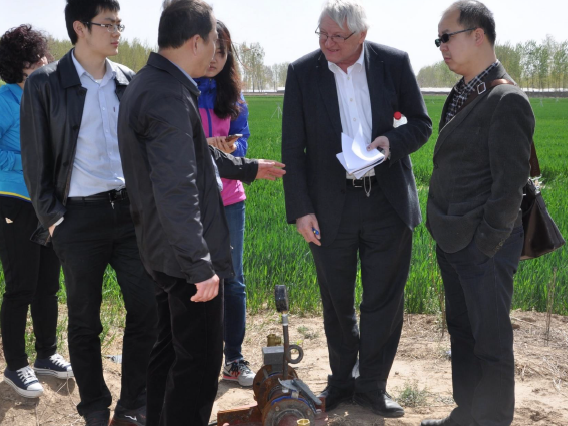
The University of Nairobi team as part of the REACH programme, has carried out comprehensive hydrogeological studies to characterise the aquifer and lay the basis for its sustainable management.
Key findings
Aquifer delineation
- Aquifer delineation has revealed that the LAAS comprises of three distinct sub-systems of shallow (<30 m), intermediate (31- 100 m) and deep aquifers (>100 m).
- The aquifer is estimated to hold 1.3 billion cubic metres of renewable and potable freshwater.
Surface water-groundwater linkages
- Strong evidence was found to support previous hypotheses of possible aquifer recharge by the Turkwel River. In addition, pulsed hydrological recharge from the Turkwel River was found to play a key role in sustaining potable water supplies in the LAAS.
- Water quality and quantity are influenced by local events, as well as events taking place in the extensive upstream catchment area of the Turkwel River (20,000 square kilometres). High climate variability, rising water demand, and land use conversion to irrigated crops in particular, were identified as key stressors.
Geological, climatic and human controls on water quality
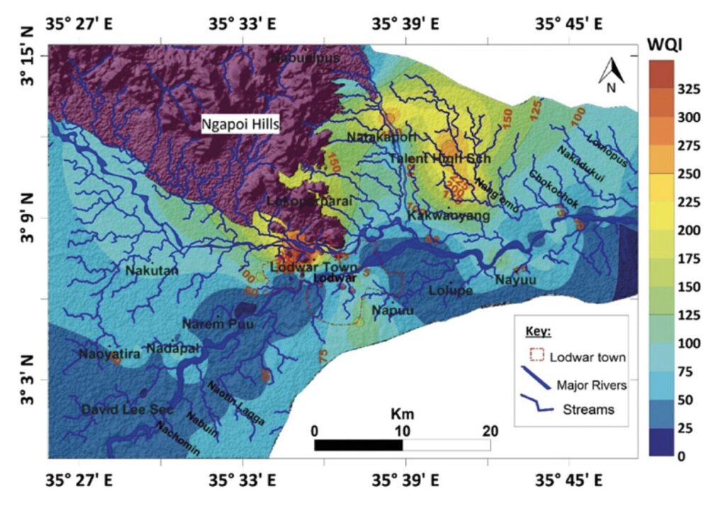
- Tritium is a naturally occurring radioactive isotope of hydrogen used to date modern groundwater. The tritium analyses indicate that potable groundwater is associated with modern rainfall (between 2002 and 2018), while saline groundwater is old (recharge before 1960) and has undetectable tritium levels. As groundwater is recharged by modern rainfall, young groundwater is vulnerable to climate variability and human contamination.
- The aquifer is highly vulnerable to natural and anthropogenic pollution. For example, the quality of water from boreholes and handpumps in the Lodwar aquifers was found to deteriorate during the wet season. This suggests a flushing of pollutants into the groundwater system by recharge water from the river and through piston recharge from the ground surface in the case of the shallow aquifer.
Scientific impacts
Research by the University of Nairobi in the LAAS has provided timely scientific data and information for a strategic urban aquifer that was previously under-researched. Findings point to the critical need for local to regional- scale environmental protection measures and for continuous monitoring of the surface and groundwater quality in order to secure groundwater resources over the long-term. The study also provides an opportunity for future comparative studies with other drylands in sub- Saharan Africa.
The research in Lodwar is also contributing to the design of aquifer monitoring and management in ongoing Horn of Africa groundwater and climate resilience programmes spearheaded by the World Bank: the North-Eastern Development Initiative (NEDI), and Horn of Africa Groundwater Resilience project (Djibouti, Ethiopia, Kenya, Somalia, South Sudan, Sudan and Uganda).
Policy and practice impact
The research has directly informed the County government’s decision-making processes on aquifer protection, groundwater development, and management. This includes the Turkana County Integrated Development Plan (CIDP) 2018/2022, the Annual Development Plan (ADP) 2020/2021, and the Turkana County Climate Change Policy (CCCP) 2020.
The County Government has incorporated key policy statements emerging from this research into the recently launched Turkana County climate change policy, and related policy documents and processes: the Turkana Climate Change Act, Turkana County Climate Change Fund Regulation and training of 360 Turkana County and Ward climate change committee members from 30 wards in the county. These are policies that aim to positively impact the county’s population of almost 1 million people.
The research has also supported the development of an Environmental Monitoring and Management Plan (EMMP), a manual that will guide current and future activities within the aquifer for its sustainable use. The EMMP proposes a customised groundwater management tool, the “REACH Model”, to ensure safe and affordable water supplies while balancing demand and supply, fuelling economic growth and subsequent poverty reduction.
Poverty impacts
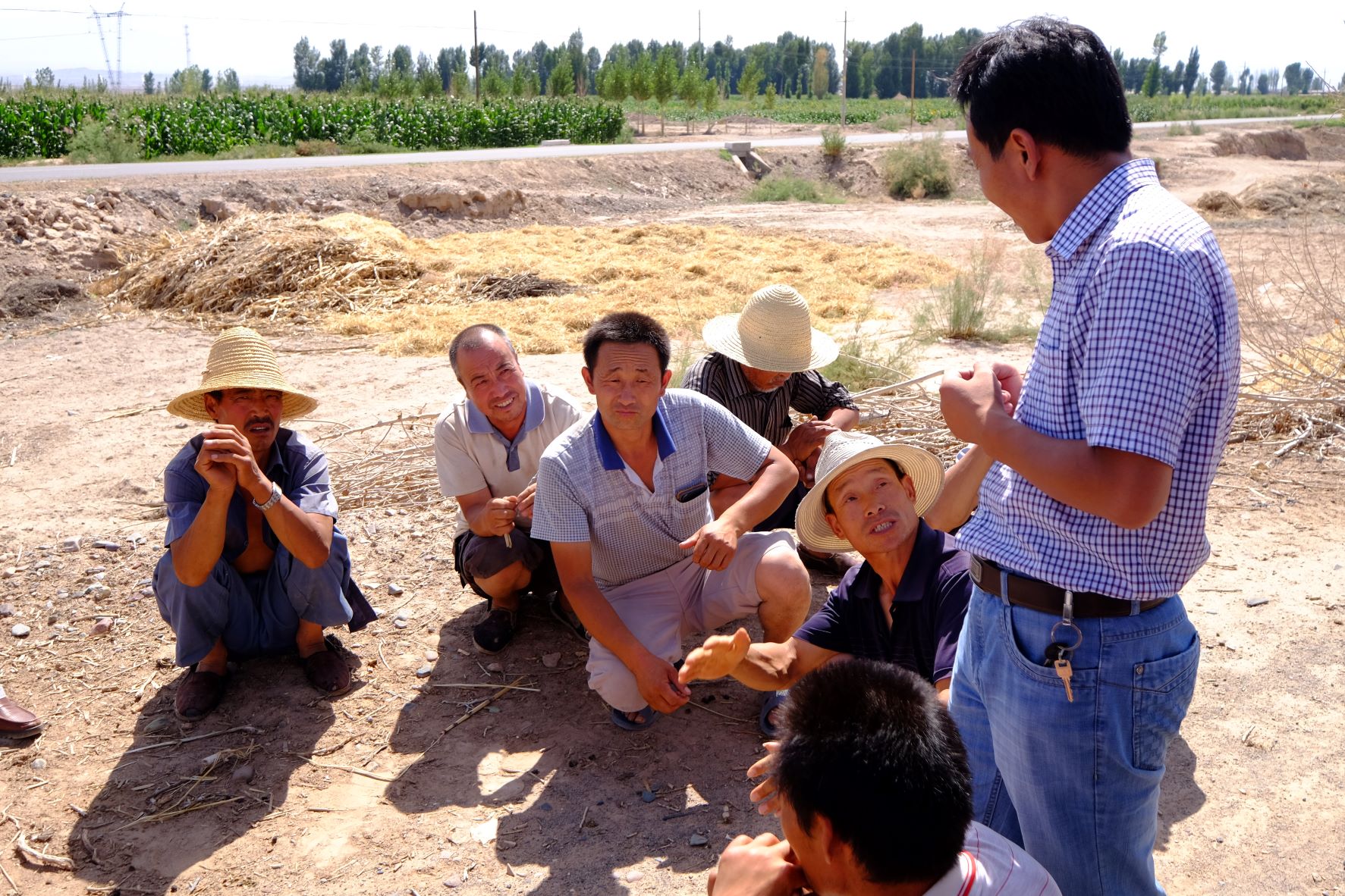
Groundwater plays a critical role in enhancing livelihood and addressing poverty in Turkana, with close to a million people depending on it for drinking, domestic uses, and livelihood support such as small-scale irrigation farming. Overall, it is estimated that 61% of rural households in Turkana County use unimproved water sources, with the majority relying on unprotected wells and streams.
Poorer households are generally located farther away from the Turkwel River and fresh groundwater resources. These areas have highly mineralised groundwater with electrical conductivity levels reaching 8260 µS/cm, making the water unsuitable for human consumption and agriculture. Piped water supply interventions are required in such areas. REACH has communicated this evidence to the Turkana County Government, and sustainable interventions are being developed.
Citation
Daniel Olago, Florence Tanui and Rob Hope (2022). Protecting groundwater for climate resilience and water security in Turkana. Story of change: Key findings and emerging impacts. REACH programme Story of Change, FCDO.
REACH is a global research programme to improve water security for the poor by delivering world-class science that transforms policy and practice. The REACH programme runs from 2015-2025 and is led by Oxford University with international consortium of partners and funded with UK Aid from the UK Government’s Foreign, Commonwealth & Development Office, Project code 201880.
Related resources
REACH Water Security for Climate Resilience Report
Policy Dialogue for Managing Groundwater Overpumping in the North China Plain
Bottom-Up Adaptive Decision-Support for Resilient Urban Water Security: Lusaka Case Study
(0) Comments
There is no content